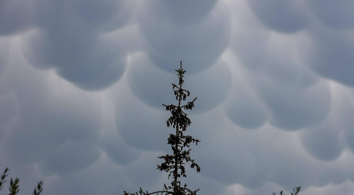
Mammatus clouds are fascinating cloud formations that are characterized by their distinctive, bag-like structure and hang on the underside of clouds.
The formation of mammatus clouds
Mammatus clouds only form under special atmospheric conditions, making them a rare and equally impressive phenomenon.
- Mammatus clouds often form at the base of cumulonimbus clouds, which are formed by strong rising air currents. This type of cloud usually occurs near thunderstorms, either shortly before or after a thunderstorm.
- The characteristic bumps are created when cold, heavy air masses sink into the cloud. As they sink, the air cools further and the hanging cloud structures form.
- High humidity plays a crucial role in the formation of mammatus clouds. It promotes the condensation of water vapor, which makes the clouds particularly dense and easily visible.
- In addition, a vertical movement of the air masses promotes the formation of the special cloud shape. The instability causes chaotic movements that form the descending cloud material.
- Another key factor in the formation of mammatus clouds is the complex interplay between temperature differences and pressure fluctuations in the atmosphere. These factors influence the dynamics of the air masses, which are partly responsible for cloud formation.
Possible effects of clouds
Although mammatus clouds can often look dramatic and threatening, they themselves are harmless. However, they can provide important clues about upcoming weather changes.
- Mammatus clouds are usually a sign of impending thunderstorms or heavy rain showers. However, they are usually not visible for more than 15 minutes.
- Due to the turbulence that can accompany the formation of mammatus clouds, they pose a potential risk to air traffic. Pilots must exercise special caution in the areas where they occur.
- In general, Mammatus clouds indicate strong atmospheric movements, which can also be associated with sudden changes in the weather.
- Their unusual shapes make them a popular subject for photographers. However, they have to be quick and ideally have a plan B in case the clouds are actually a harbinger of heavy rain showers or thunderstorms.
Also interesting:
- Photographing lightning during a thunderstorm: How to take successful photos during a thunderstorm
- Probability of rain in the weather forecast: How the calculation works
- Thunder and lightning: This is what happens
- Is it dangerous to use your phone during a thunderstorm? What you need to know